
Overview
Helios provides nationwide, turnkey aerial survey support by bringing together aircraft, pilots, and a range of sensor options including pod-mounted systems, wide-area LiDAR, and large-format aerial imagery under a single team. This approach delivers reliable execution and flexible deployment across a wide range of mission types.
High-Wing Aircraft & Pod Sensor Flight Support
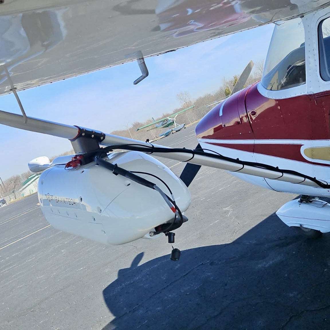
Helios is expanding its nationwide aerial survey capacity through an integrated network built around mission-ready, high-wing aircraft designed for strut-mounted sensor operations. This network combines aircraft, survey pilots, operators, sensor owners, and approved maintenance facilities into a coordinated platform capable of rapid deployment across the United States.
All operations are managed through Helios’ centralized mission control and standardized workflows, with flights conducted by experienced survey pilots aligned with our safety and operational standards. Aircraft operating within the network are covered under Helios’ insurance while on mission, supporting consistent compliance and risk management.
With dependable coverage across all regions, the Helios Network allows projects to scale efficiently, from single-site collections to large, multi-state campaigns. Backed by a broad ecosystem of aviation and sensor partners, the network delivers flexible capacity, reliable execution, and consistent results wherever missions are required.
Mission Logistics
Helios manages the logistics required to execute aerial survey missions efficiently through the Helios’ High-Wing Fleet. If you provide your own sensor, Helios coordinates the aircraft, experienced survey pilot, and maintenance inspector to meet your technician at the designated airport for sensor installation. Once installed and approved, the mission is flown, and the sensor is removed at a location that best supports your operational needs.
If you do not own a sensor, Helios can arrange a rental system tailored to your project requirements. The sensor is shipped to the most operationally efficient airport near the project site, where installation, approval, and mission execution are completed under Helios’ standardized procedures.
Range & Locations
The Helios’ High-Wing Fleet is ready to offer turnkey crew and aircrafts from the following cities:
- Dallas (DFW)
- Phoenix (PHX)
- Los Angeles (LAX)
- San Francisco (SFO)
- Charlotte (CLT)
- Orlando (MCO)
- Kansas City (MCI)
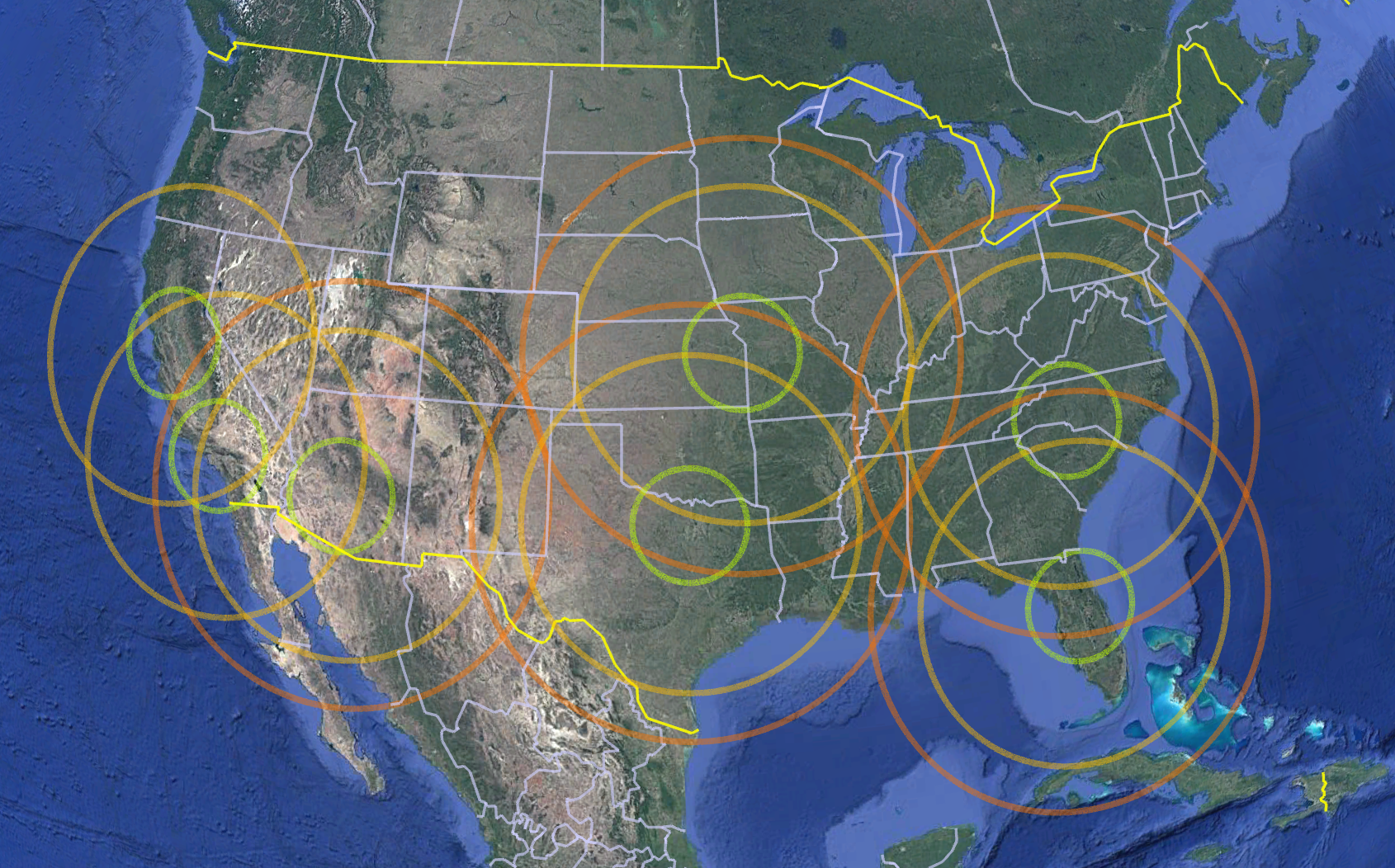
GREEN Circle: Represents the area we can cover within a single full lift, allowing for 2 hours of on-site flying time.
YELLOW Circle: Indicates the area we can relocate to via a 3-hour ferry flight, including all equipment and luggage.
ORANGE Circle: Denotes the maximum distance we can travel in one extended ferry flight.
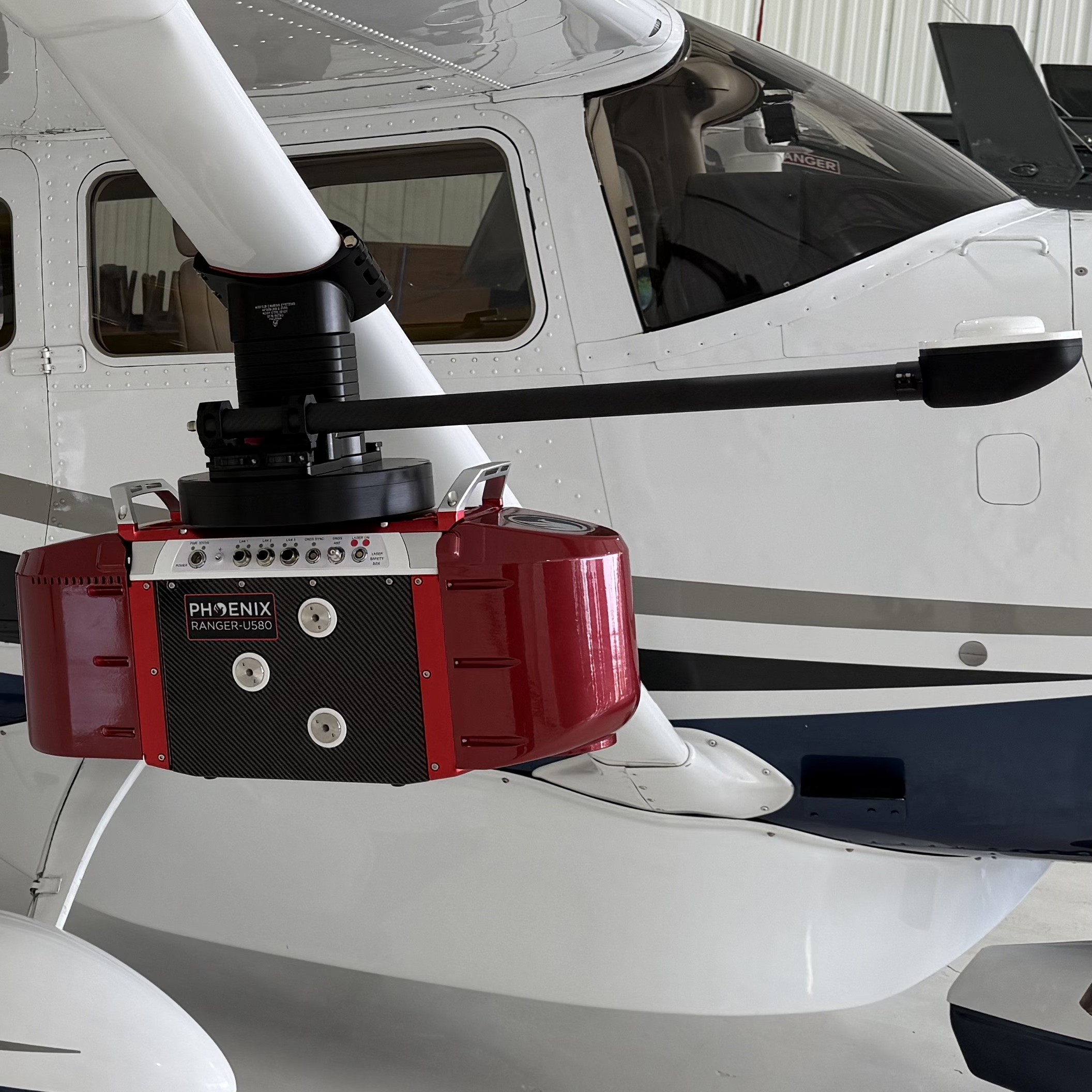
Partner Sensor Capabilities
Through trusted industry partners within our Network, Helios provides access to a range of proven aerial survey sensors that support imaging and LiDAR missions across diverse project requirements. These systems are compatible with the Helios’ multi-engine aircraft or High-Wing Fleet and are deployed under standardized installation and operational procedures.
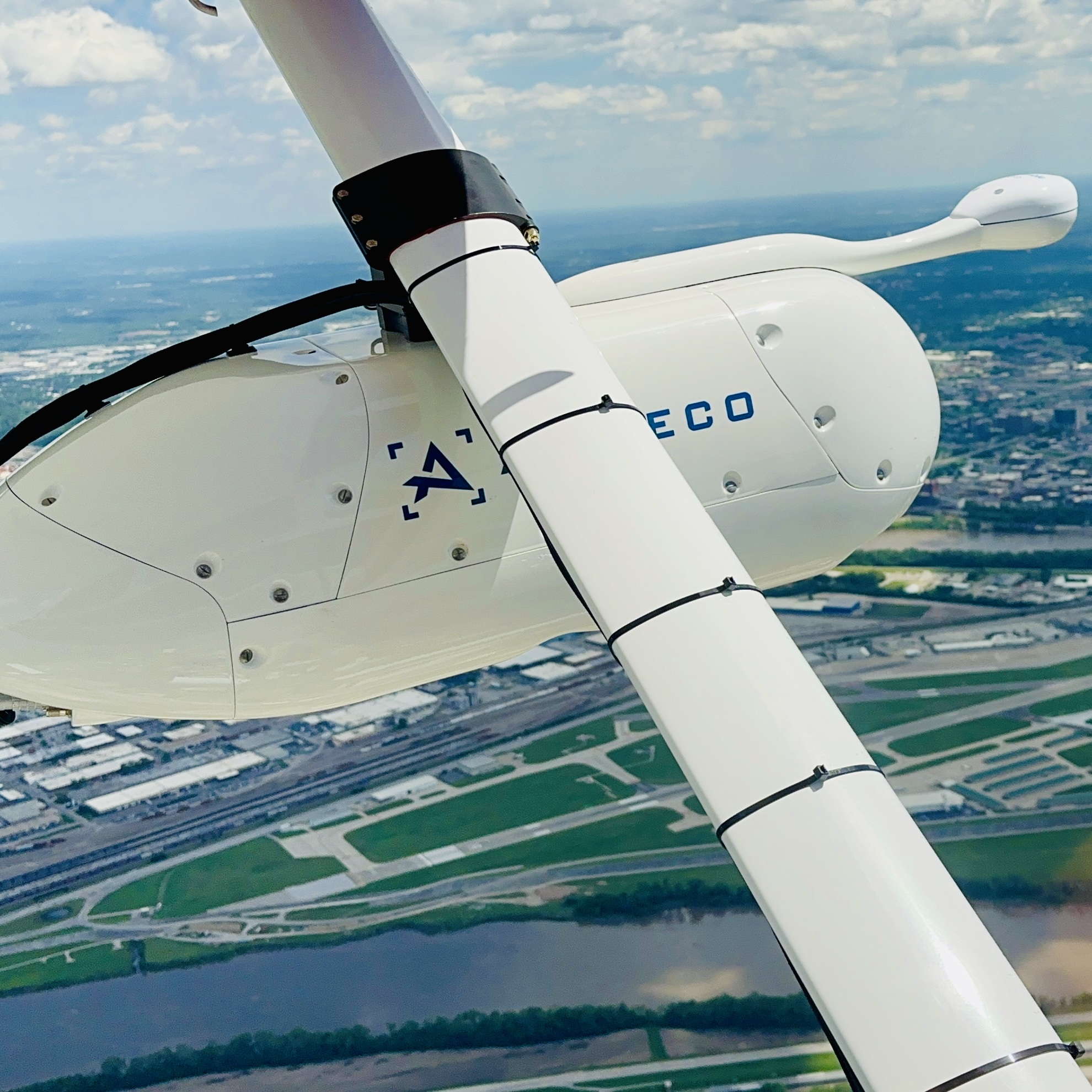
Pod Sensor Systems
Helios supports pod-hosted sensor configurations designed to accommodate a variety of LiDAR and aerial imagery options, including dual-collection platforms capable of capturing complementary datasets in a single airborne package. These configurations support a wide range of mapping, corridor, and survey missions while maintaining high data quality and operational efficiency. Pod-based systems allow for rapid installation and removal, precise sensor alignment, and the flexibility to adapt sensor payloads to meet evolving project requirements.
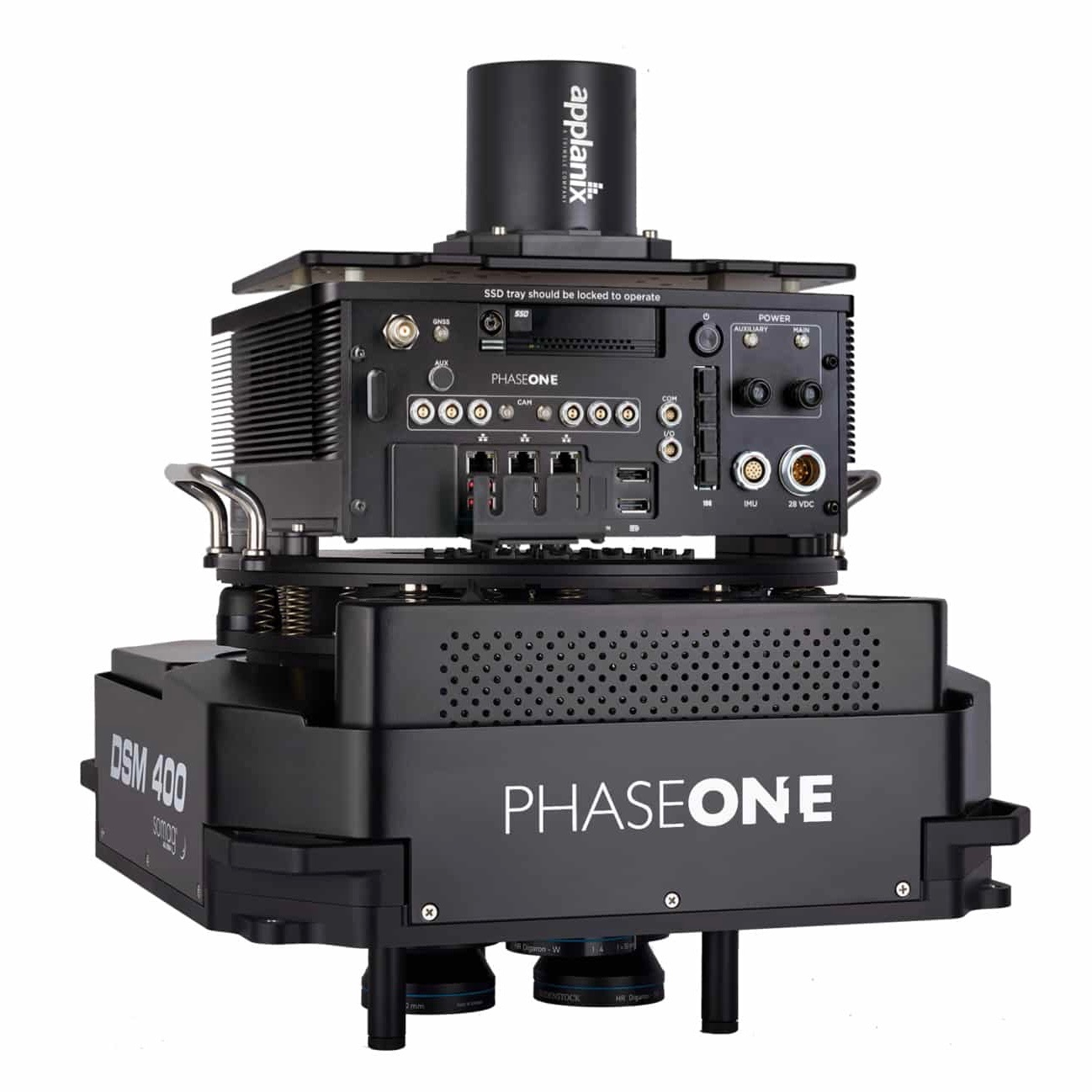
Phase One PAS 280 – Large Format Imagery
The Phase One PAS 280 is a large-format aerial imaging system designed for high-accuracy photogrammetry and mapping applications. Known for its image quality, geometric stability, and reliability, the PAS 280 supports projects requiring detailed, high-resolution imagery over large areas, including mapping, planning, and infrastructure assessment.
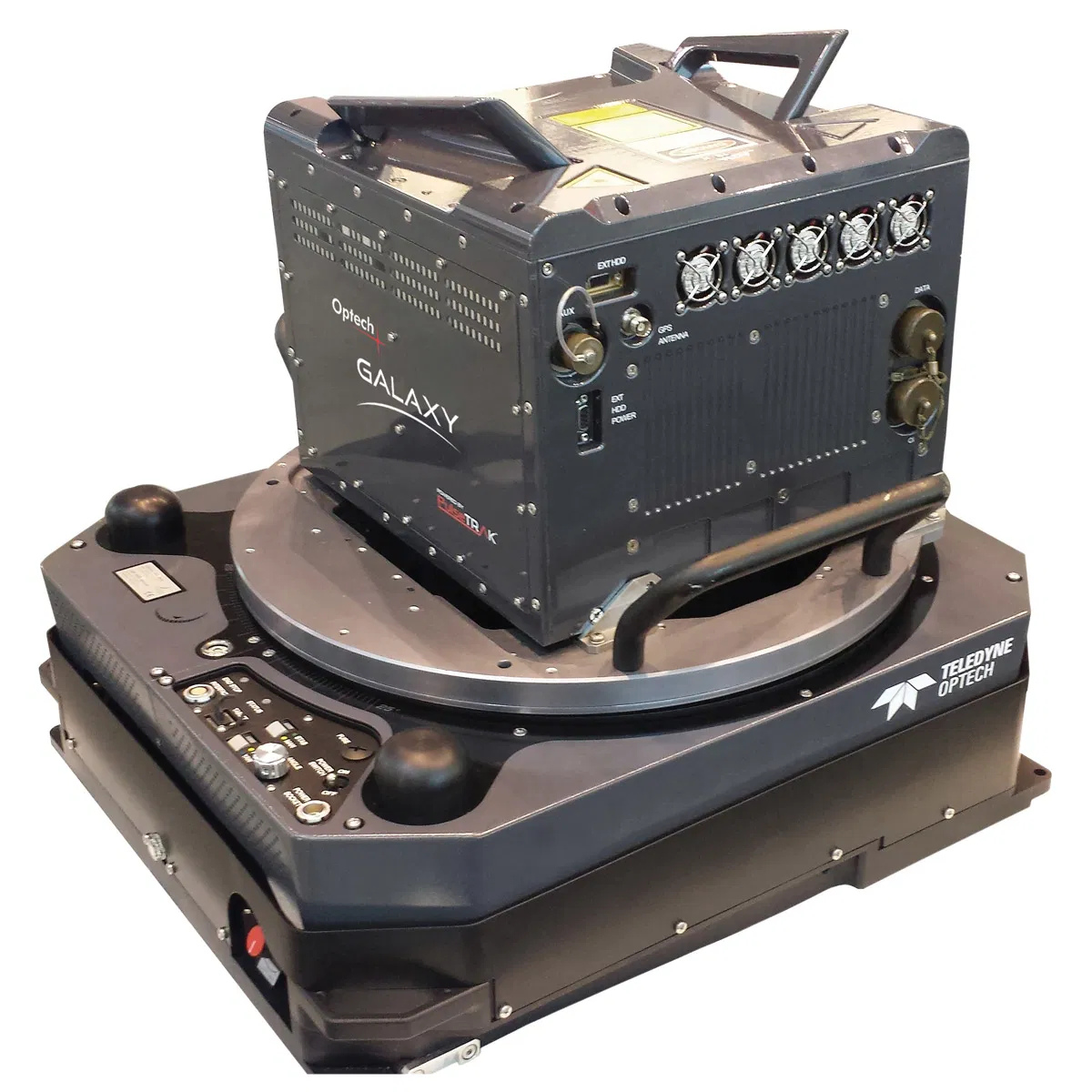
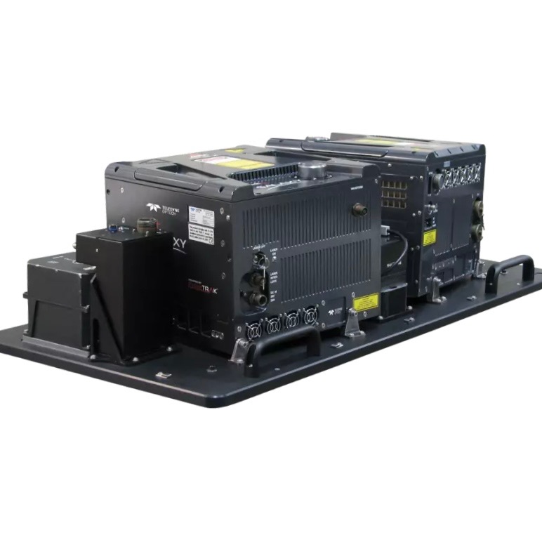
Galaxy T2000 LiDAR Sensor
The Optech Galaxy T2000 is a wide-area, high-performance airborne LiDAR system suitable for a wide range of topographic and corridor mapping missions. It delivers dense, accurate point clouds and performs reliably across varied terrain and operating conditions, making it well-suited for engineering, utility, and environmental applications.
Need More Versatility? Let’s Begin.
Discover how Helios’ network of aircraft and sensors can scale your capacity and enhance flexibility.